
Glinsk [Glinsce]
Good walks are even better shared.
Overview
Exploring Glinsk [Glinsce]
Nestled amidst the stunning landscapes of Northern Ireland, Glinsk, also known as Glinsce, offers a delightful retreat for hikers and nature enthusiasts. Standing at 559 meters, this Marilyn mountain is renowned not only for its versatile terrain but also for its spectacular views.
Geology
Glinsk is primarily composed of Silurian quartzite, a resilient rock that has weathered the elements remarkably well. The rugged landscape showcases steep crags and grassy slopes, which are perfect for those eager to explore its unique geological features while enjoying the flora and fauna that thrive in this rich environment.
Routes
The Glinsk Hill Loop is a popular route starting from the village, providing a moderate challenge that can be easily managed in about 1.5 hours. This 4.5 km loop offers a bit of everything — stunning scenery and a feeling of accomplishment. Just remember to keep your eyes peeled for stray sheep that might have other ideas about the right way to wander.
Summit Features
At the summit, you'll be greeted by a friendly stone cairn that offers a vantage point for breathtaking views of the Mourne Mountains and Carlingford Lough. It’s the kind of place where you can sit, take it all in, and maybe even contemplate life’s big questions — like what’s for dinner?
Terrain
The slopes of Glinsk present a delightful challenge with a mix of rocky outcrops and gentle grassy areas. It's a comfortable hike for most, although special attention should be paid to the weather as the rocky parts can be a tad slippery.
Views
From the summit, you’ll be graced with sweeping vistas. On a clear day, you might just catch a glimpse of distant landmarks that make you feel like a conquering hero of the highlands. For the best views, consider visiting during spring or autumn when nature wears its most vibrant colours.
Hazards
Be cautious of slippery rocks, especially after rain. One misstep could lead to an unintended outdoor performance that you might not live down!
Nearby Summits
For those looking for more adventures, nearby summits include Slieve Foy (655 meters) and Gullion Mountain (573 meters). They offer further exploration opportunities without too much extra travel.
Access
The nearest parking for your epic start is in the village of Glinsk, a short walk from the trailhead. While public transport is somewhat limited, busses do ply the route to the village, so check your schedules. The nearest town, Newry, is about 15 km away and provides more options if you’re looking to stock up on gear or supplies.
Facilities
After your spirited hike, Glinsk has charming cafes where you can refuel with a decent cuppa and perhaps a slice of homemade cake to match. Public toilets in the village offer a necessary relief before heading back into the wild.
History
The name 'Glinsk' comes from the Irish and means 'Glen of the Fear', reflecting local folklore that adds depth to your visit. This area has historical ties to ancient communities and is steeped in stories waiting to be discovered.
Remember to enjoy your time at Glinsk, breathe in the fresh air, and perhaps ponder what other mischief you can get up to on your next adventure!
Happy hiking!
Explore routes near Glinsk [Glinsce]
Public walks starting within 80 km of this hill. Nearby does not mean a route reaches the summit; check its map and access before setting out.
No public routes are currently listed within 80 km of Glinsk [Glinsce] on Walkmates. This does not mean there are no paths here. Explore the map and check local access information before planning a walk.
Route planning notes
These notes describe possible approaches, not verified navigable routes or permission to cross land. Check current paths, local access rules and conditions before setting out.
Glinsk Hill Loop
A scenic loop starting from the nearby village, offering gradual ascents and captivating views along the way.
Make a day of it, together
Find someone to share the walk with, or organise a day out along a route you like.
Hill facts and local notes
Classifications
Elevation
304m
997 ft
Prominence
178m
Coordinates
54.3159, -9.6173
F948420
OS Map
23
At the Summit
The summit features a small stone cairn, which has seen better days but still stands proud, along with remarkable panoramic views across the surrounding countryside.
Terrain & Geology
Glinsk is primarily composed of Silurian quartzite, known for its hardiness and resistance to erosion. The rocky crags provide a stunning contrast to the lush green surroundings, making it a geologist's delight.
Views & Scenery
On a clear day, the views extend to the Mourne Mountains and the shimmering waters of Carlingford Lough.
History & Heritage
Name Origin
The name 'Glinsk' is derived from the Irish 'Gleann na hEagla' meaning 'Glen of the Fear', a nod to its local folklore.
Historical Significance
Glinsk has historical ties to local farming communities and is often a backdrop for tales of ancient warriors and folklore.
Getting There & Facilities
Check current local access restrictions, parking rules and transport timetables before travelling. These notes do not confirm public access to the summit.
Parking
There is a small parking area in the village of Glinsk, just a short walk from the trailhead. Please park considerately to avoid blocking access.
Public Transport
While public transport options can be limited, there are bus services from nearby towns to the village. Be sure to check the local schedules.
Nearby Facilities
A couple of quaint cafés are located in Glinsk, where you can grab a hearty meal or a cup of tea after your adventure. Public toilets are available in the village.
Safety Information
Known Hazards
- Potentially slippery rocks, especially after rain; watch your footing, or you might make a fool of yourself (and possibly a lovely slip on social media).
General Safety Tips
- Check weather conditions before setting out
- Carry appropriate clothing and equipment
- Let someone know your planned route
- Take a map, compass, and GPS device
- Carry emergency supplies: food, water, first aid kit, torch
Hills
Some common questions about the hills answered
Are there group walks up Glinsk [Glinsce]?
Many walkers use Walkmates to join or organise walks with others. You can check for group walks around Glinsk [Glinsce] through the maps
Are there other walkers around Glinsk [Glinsce]?
Activity varies by location and time, but Walkmates lets you see whether others have shared walks or shown interest in this area. Find other people through the walking friends search walking friends for Glinsk [Glinsce] search or of course create your own walk for Glinsk [Glinsce]
Can I organise a walk to Glinsk [Glinsce]?
Yes. If there aren’t any walks listed already, you can create a walk and make it available for others to join.
If you're signed up to Walkmates, you can create a walk to Glinsk [Glinsce].
How do I find a walk up this hill?
There are often multiple ways to walk this hill, depending on experience and route preference. Walkmates helps you explore walks and routes that others have shared.
Can I suggest a new route up Glinsk [Glinsce]?
Yes. You can suggest or create routes to share with others. Walkmates focuses on the social side of walking, so routes are used to help people organise walks and explore areas together, rather than as detailed navigation tools or route libraries.
Other uses really appreciate knowledgeable walkers sharing their routes. Share your favourite route to Glinsk [Glinsce] here
The is an error or something incorrect about this hill. How do I let you know?
We always strive to keep the information on Walkmates as accurate as possible. If you find an error, please let us know through the contact form and we'll aim to correct it as quickly as possible
Community Discussion
Comments
Location
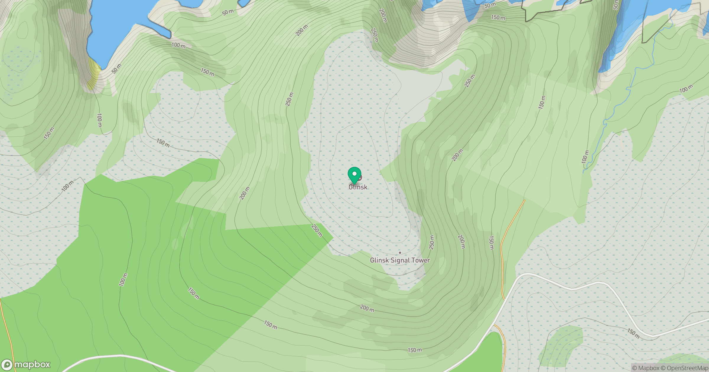
Grid reference: F948420
View on OpenStreetMapOpens a map in a new tab, centred on the hill.
Hills within 30 km
Straight-line distance, not a walking route or confirmation of access.
No comments yet. Be the first.